The April showers have certainly made an appearance this spring but that’s no reason to stay indoors, the Island is coming to life and signs of the new season are everywhere and can be spotted on this circular walk.
The Culver Trail is a popular walk of around three and a half miles with plenty of information boards along the way, and you should expect it to take roughly two hours. Starting and finishing at the Isle of Wight’s last remaining windmill which dates from the 1700s and is today in the care of the National Trust. Here you will find the first noticeboard which depicts the start of the trail.
As you head down the hill, you will have a view of Culver Down directly ahead of you, which is topped by the Yarborough Memorial and you may glimpse Brading Marshes, an RSPB nature reserve which is a haven for the Island’s wildlife, including buzzards, little egrets, green woodpeckers and marsh harriers to butterflies, hobbies and red squirrels.
At the bottom of the hill, you’ll enter Steyne Wood which contains some ancient trees as well as another information board. At the end of the wood, head through the gates and bear right. A short walk up a path leads you to views over Bembridge Airport, where you will find another information board detailing the history of the airport. Continue along the road until the signpost for byway BB37, here you will find the next noticeboard, across from which is a pretty duck pond.
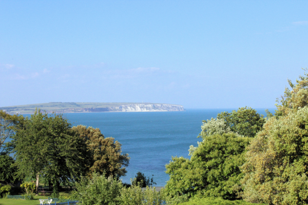
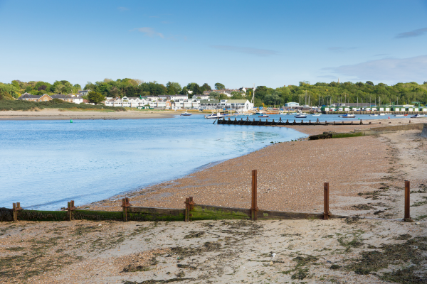
Continue up Peacock Hill where you will find another noticeboard and climb over the stile into the field. Cross the field to another stile, but make sure to look back to where you came from for a view of Bembridge Harbour, and No Man’s Land Fort in the middle of the Solent.
Climb over the second stile and head up a fairly steep path with further views of Bembridge and St Helens. From here, head directly to the obelisk monument ahead of you, crossing through the gate at the edge of the road and turn right to the next information board. Here, you will be rewarded by panoramic views over Sandown Bay, plus Ventnor & St Boniface Downs in the distance.
Now seems like the perfect time for a pitstop and thankfully The Culver Haven Inn offers just that. Set atop of Culver Down, the popular pub serves up excellent food and drink, as well as boasting one of the most spectacular views on the Island. Once sated, you’re now on the downward slope as you continue along the road until it forks, taking the righthand side.
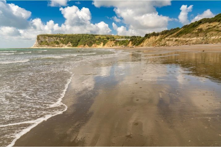
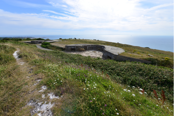
You will find the remains of two gun emplacements, walk diagonally across the car park where you will find a path leading to a gate and then turn immediately right. You should now have Whitecliff Bay right ahead of you with a view of Bembridge Ledge. At the bottom of the path, cross over the stile and continue down the descent where it will open into a field before returning to a well-trodden footpath again and another noticeboard giving further information about the geology of the area.
Continue along the path, crossing over a concrete path before rejoining the path, which forks at this point. Take the path which goes through the wooded area with the cliff on your right-hand side. You will come across the next noticeboard near the building of Bembridge School, built in 1919. Follow the path, until it takes a sharp left, and soon opens up into Jenny Streets Lane.
Keep to the right of the road and you will find the final noticeboard. Turn right onto footpath BB22, and continue through the wood and along the path, until you get to a junction. Turn right here and you will start to climb up the hill back to Bembridge Windmill, ending the Culver Haven Trail – well done!